Newsletters
September 2009 - Quequechan River, EOEA, Peace Haven
WELCOME TO GREEN FUTURES !
SEPTEMBER. 2009
“I know the joy of fishes in the river through my own joy, as I go walking along the same river.”
- Zhuangzi
“No man ever steps in the same river twice, for it's not the same river and he's not the same man.”
- Heraclitus
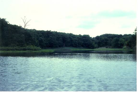
Quequechan River –
On the evening of September 17, a program entitled, “The Hidden Divide – The Struggle for the Quequechan Watercourse: Private Rights Versus the Public Interest,“ was held at Bristol Community College.
This program on the Quequechan was one in a series on community issues held to celebrate the 150th anniversary of the Massachusetts Superior Court System.
Our own Al Lima gave an overview of the river from the colonial era up to the present. Others speaking on various aspects of the river and its history included Attorneys William Kenny and Jay Lambert; John Friar from the Fall River Water Department; and John Grovesnor and Donald Leighton of Newport Collaborative Architects …the group hired to facilitate the Fall River Energy Enterprise (FREE) initiative.
A montage of early Quequechan River photographs was assembled by Strefani Koorey and shown during the program. Check it out here - http://www.youtube.com/watch?v=ZndEM-gZpY8
Viewing these early photos it is important to note that although the power provided by the Quequechan was what first attracted Lancashire English textile entrepreneurs to the banks of the river …and created their family fortunes …the resource was soon squandered and the Quequechan became little more than an open sewer draining a rapidly urbanizing community.
Once the steam engine came along and Quequechan water power was no longer needed, the defiled and degraded river was of little monetary value so was paved over, bit by bit. The photos of the privies hanging over the river and sewerage running unchecked down neighboring streets …as well as the shots of the dumping of domestic and industrial waste to fill in the river’s shallow coves …shock us today, but were accepted by most in that not so distant past.
After all, these textile mill owners and supervisors lived on the hills well above the river. They didn’t live with the stench of the befouled Quequechan in their nostrils. Cheap labor, “the wretched masses of your teeming shore” …was inexhaustible ….and expendable. Starving Irish and other desperate immigrants had little choice but to live and labor along the foul and noxious Quequechan.
Anyone have a time machine? Wouldn’t it be wonderful to view the falls of the Quequechan pre European arrival? Tons of pure water crashing down the granite precipice through a pristine forest to the Taunton River and Mount Hope Bay. Must have been quite the scene.
We continue to work with all Quequechan advocates to restore the river and daylight the falls.
Executive Office of Energy and Environmental Affairs –
A gigantic mistake was made when incoming Governor Deval Patrick foolishly added “energy” to the Executive Office of Environmental Affairs.
That foolishness was compounded when Patrick appointed lackey Ian Bowles as head of that very important office.
We objected, but where was the outrage from major statewide environmental groups? Hardly a whimper! Shame on them!
The result of Patrick’s action is that energy trumps environment just about every time. That’s just what we feared …and expected.
Last month we warned Somerset that solid waste incineration, under the guise of waste gasification to generate electricity, was coming to an old power plant in town. Somerset isn’t alone.
A “virgin biomass” plant is slated for Russell, Massachusetts. Another is in the planning stage in Greenfield. More are on the drawing board, across the state, and all are being actively encouraged by those in state environmental regulatory positions that have been charged with protecting our environment.
These are NOT alternative energy projects. Time, money and resources are being wasted while true alternatives wait at the end of the line.
All of these “biomass” plants will end up as giant trash incinerators. Anyone believe we are going to clear-cut Massachusetts to feed this very inefficient way to produce electricity?
The Russell plant alone is projected to burn 650,000 TONS of wood annually. Besides the hundreds of thousands of tons of carbon dioxide and pollutants that will spew into the air, the diesel fuel to truck our state’s remaining forests to the power plant will consume at least 416,000 gallons of diesel fuel per year.
Massachusetts must continue the ban on trash incineration, develop a comprehensive trash re-cycling and solid waste master plan, fund true alternative sources for producing energy, stop funding failed attempts at large-scale gasification, encourage conservation and wise use of available energy supplies.
Check out what Greenfield is doing, here - http://www.greenfieldbiomass.info/
Peace Haven -
Excellent news from Preservation Massachusetts.
Here’s their news release dated September 18, 2009
Peace Haven Listed Amongst Massachusetts Most Endangered Historic Resources
Hidden landscape with amazing historic and archeological significance faces impact from development
Peace Haven in Freetown has been named one of Massachusetts’ “Most Endangered Historic Resources”. Since 1993, this list is compiled annually by Preservation Massachusetts, the state’s historic preservation advocacy organization, as part of an advocacy and education program.
Peace Haven is a 600-acre site along the Taunton River in Freetown, just north of Fall River’s city boundary. Though 300 acres of the northern half is a Stop and Shop warehouse facility and the interior of the southern 300 acres was the site of the Algonquin Gas facility, the historic landscapes and features are still in pristine condition. The western side of the site is bordered by the Taunton River, which was just designated as Wild and Scenic by the US Congress earlier this year. It is also part of the Taunton River Greenway and bounds the SE Mass Bioreserve in Fall River.
The landscape’s historic significance goes back to King Philip’s War, when in 1675 King Philip and Queen Weetamoe crossed Peace Haven while fleeing the English. Its archeological resources from this time and earlier are amazing and well documented at the State Archives. Peace Haven was utilized as a dairy farm through the colonial era right until modern times and the construction of the gas facility. The name “Peace Haven” comes from the land’s farming days. Though no historic buildings are still remaining, the incredible landscape, cultural and archeological history make this a rare treasure in this part of the state.
Jim Igoe, President of Preservation Massachusetts feels strongly about this particular landscape.”
Peace Haven faces a number of threats. A proposed interstate ramp on nearby Rt. 24 and siting for a commuter rail line will make Peace Haven a target for development. The site is currently zoned industrial as the Riverfront Industrial Park, and this allows for big box stores and other large-scale construction.
The historic landscape of Peace Haven is invisible from the road and not many people are aware of the historic, landscape and cultural assets at risk. Local advocates would like to work collaboratively with key parties to concentrate development and growth in the already industrialized portion of the site, bringing economic development while preserving and educating the public about the tremendous history of Peace Haven.
If you’re not familiar with Peace Haven, here’s some background information:

Barnaby's Cove, Peace Haven
The Importance of Peace Haven – Over 12,000 Years of Continuous Human Habitation
“In the end our society will be defined not only by what we create but by what we refuse to destroy.” – John Sawhill
Known since Colonial times as Peace Haven, the land lying along the Taunton River from Barnaby’s Cove north to the confluence of the Assonet and Taunton Rivers has been continuously inhabited by man for close to 12,000 years. It is unique in that archaeological excavations extending over 70 years by Roy Athearn and his associates has resulted in the discovery of Paleo-Indian settlements here dating from just after the receding of the glaciers at the end of the last ice age.
Peace Have is one of the few locations in New England with such a long unbroken human record. Peace Haven’s proximity to major shellfish beds, anadromous fish runs, extensive system of interconnecting waterways for easy travel, fertile slopes oriented to the southwest and sheltered position in the Taunton River valley providing a longer growing season than the rest of New England, all provided ideal habitat for human settlement. Whether during the Paleolithic, Archaic, Historic or Industrial eras, Peace Haven has always been able to provide its inhabitants with more than just the basic necessities of life.
Peace Haven is considered one of the most thoroughly documented archaeological sites in the Commonwealth and one of the most significant. The site has been the subject of many articles in the Journal of the Massachusetts Archaeological Society and other publications on archaeology. Some of the many artifacts unearthed at the site are on display at the Somerset Historical Society and recorded with the Massachusetts Historical Commission.
Peace Haven also includes one of the most significant geological features in the area remaining from the past ice age, a large intact esker.
Eskers are elongated serpentine ridges, many reaching over thirty feet in height. They were formed when fissures and crevasses in glacial ice allowed melt water through forming streams beneath the glacier that over thousands of years deposited layers of sand, gravel and boulders.
When the glacier eventually melts away, esker formations are revealed. Since locally occurring eskers have been exploited for their gravel deposits, over the last hundred years, most have been stripped of their gravel, turned in gravel pits and thus been destroyed.
Peace Haven was also the site of one of the key incidents that resulted in the start of King Philip’s War. On July 19, 1675, following opening hostilities between the Wampanoags and the English settlers in Swansea, King Philip and Weetamoe fought the English in the battle of the Great Pocasset Swamp. Many English casualties resulted, allowing the Wampanoag warriors to escape by travelling along the east side of Watuppa Pond and then down an old Indian trail that the English settlers Called Mowry Path. Mowry Path terminated at Winslow’s Point at Peace Haven, where an Indian ferry was located. King Philip, Weetamoe and their warriors were ferried across the Taunton River which allowed their advance toward central Massachusetts where they joined with some Nipmuck and thus began what is known today as King Philip’s War.
The escape from Winslow’s Point was the last opportunity for the English to avoid war. Had King Philip and Weetamoe been intercepted at Winslow’s Point, the Indian uprising would have been ended and the course of New England history changed dramatically.
On August 3, 1676, Weetamoe, who had remained loyal to Philip throughout the war, drowned in the Taunton River, just south of Peace Haven, while trying to escape the Taunton Militia. She was found dead on the Somerset shore.
Peace Haven is also rich in natural history. The biological diversity of Peace Haven, as we’ve already noted, is the reason for the continuing presence of humans for the past 12,000 years. Some of the bounty, oysters, soft shell clams, quahogs, blue crabs, eels, striped bass and white perch are still found there today. Ospreys still patrol the river and wintering bald eagles are becoming more than an occasional visitor. The endangered Atlantic sturgeon prowls the deeper holes in the river and two Massachusetts listed “species of special concern” …the diamondback terrapin is returning to the river’s salt marshes and spotted turtles are becoming more frequent in the freshwater area of upper Hathaway’s Cove.
The salt marshes and uplands of Barnaby’s Cove are well vegetated and contain many indigenous species. There are some exemplary examples of sassafras and white oak along the peninsula.
Commercial, industrial and residential growth is at an all time high in southeastern Massachusetts. As a result, not only wildlife habitats and open space recreational lands are being put in jeopardy, but historical sites are increasingly being threatened and destroyed.
Many parcels may be suited for developments. However, every so often, certain properties are slated for development that are exceptional in their biological and historical scope and value. Peace haven is one of these sites.
ALLIED WASTE AND FALL RIVER’S MOUNT TRASHMORE -
Quick!!! Call the local news media. Great visual of largest solid waste dump in Massachusetts looming over City’s water supply.
Desperate to keep the dump operating, Allied Waste, Fall River, and the Massachusetts Department Encouraging Pollution (DEP) have decided there’s still a teensy-weensy piece of Mount Trashmore, on the south, southeast side, that can receive some more abuse.
A few of us were on Wilson Road, Fall River, looking at the gorgeous fall colors developing along the still pristine shores of Pond Swamp, but unfortunately men and huge machines could be seen on the steep slopes of Mount Trashmore setting in place dump “liner” material, setting the stage for continued dumping next to our municipal water supply. What a shame.
Go take a look …you won’t believe it! A foolish, foolish city.
AUTUMN IS HERE –
The weather has been perfect for exploring your natural environment. Get outside and do it. Need an organized activity? Click on our Calendar to see fun and educational things to do.
<Back
Social